Informática
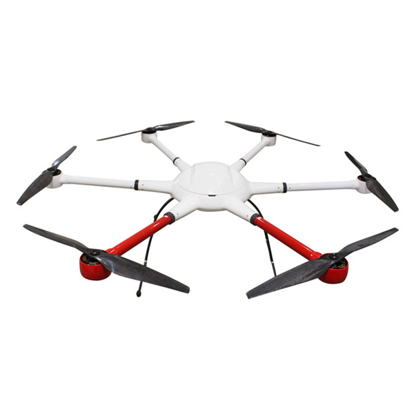
Aerial UAV—Control Survey
The Aerial UAV is to ensure the accuracy of aerial triangulation and determine the absolute position of objects in space. In the conventional low altitude digital aerial photogrammetry external specification, the layout of control points is specified in detail, which is the basis for ensuring the accuracy of large scale mapping. The technique of oblique photograph requires higher image overlap than traditional photography, and the requirement of image control point layout is not suitable for high resolution unmanned aerial UAV oblique photogrammetry. Aerial UAV usually adopts GPS positioning mode, and has POS data itself. It plays a significant role in determining the relative position between images, and can improve the accuracy of empty three computation.
1 Conventional three-dimensional modeling
Based on the Smart 3D algorithm, a control interval can be provided from the angle of the final aerial triangulation feature point-cloud. The proposed value is to set a control point at every 20000~40000 pixels, in which the difference POS data (relatively accurate initial value) can be relaxed to 40000 pixels, and at least 20000 pixels of the differential POS data are set. At the same time, it should be applied flexibly according to the actual terrain and terrain conditions of each task, such as very large terrain undulating, large area vegetation and surface water features very few, and need to increase the control point. The measurement of control points adopts attached traverse measurement to get high-precision location information.
2 Safeguard of emergency surveying and mapping
After the earthquake, landslides, debris flow and other natural disasters, in order to obtain the disaster area's three-dimensional data, we can not control the measurement according to the traditional operation mode. By reading the coordinates of the Google map, the handed GPS measurement, and the RTK measurement, the few control points of the disaster area can be quickly obtained, and the real three-dimensional model of the disaster area can be generated to provide assistance for post-disaster relief.
3 The selection requirements of point location
The target image of the image control point should be clear, and select the place where the spot is easy to be identified, is fixed and easy to measure.When the condition is available, we can make the mark point of the control point of the field work first, usually choose the white (or red) paint to mark the cross sign, and test several images before the aerial photography to ensure that the cross sign can be correctly identified on the oblique image. After the control point measurement is completed, it is necessary to make the control point distribution map in time, control the spot information table, accurately describe the location and position information of each control point, and facilitate the use of the internal pricking points.
Ubicación : NO.15 Chaoyang road, Yanluo street, Songgang town, Baoan District, Shenzhen , 518055 Shenzhen,
Persona a contactar : flying titan, +75 5 21 53 90 34
Inscrito el 23 abril 2018
Buen trato: comprar del vendedor
Visita nuestra guía para una transacción segura! En ningún caso Algomtl no se hace responsable de los anuncios. Sólo la responsabilidad del vendedor o del comprador en caso de litigio está involucrado. Por favor, lea nuestras condiciones de uso. También puede visitar nuestras preguntas frecuentes y ver nuestra información sobre los riesgos relacionados con la falsificación.
Esta página es acerca de los importadores y exportadores de
Aerial UAV—Control Survey
Buscar en la categoria : Informática
Buscar en la categoria :
uav—control, aerial, survey
|
Thursday 28 April 2016
Estamos ofreciendo los siguientes productos a precios muy competitivos y en la mayoría de los términos de negocio seguro y seguro . Por lo que sólo los compradores genuinos y serios que quieren hacer uso de nuestra oferta especial, son bienvenidos para enviarnos su consulta . Pero...
Tuesday 23 June 2026
Matériel: Coton 100% Utilisation: Maison, Hôtel, Sports, cuisine, Plage, Avion, Cadeau, Sac, literie, doublure, textile à la maison, canapé Point d'origine: La Tunisie 100% coton: serviette de hammam Type d'alimentation: Faire- à- commande couleures: tout les couleures disponibles Taille...
- 5070 - KSAR HELAL
- 58153745
- +21 6 58 15 37 45
Tuesday 23 June 2026
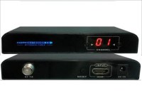
▲VE-30RFM RX (Front / Rear) ▲VE-30RFM TX (Front / Rear) VE-30RFM HDMI to RF Matrix Extender is designed to convert HDMI signal to HD digital TV signal based on DVB-T CATV signal, it uses 64QAM mode to realize the HD digital TV signal conversion and transmit via coaxial cables for...
- meicheng
- 23511 - New Taipei City
- 886 2 82280311
|