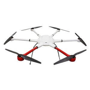
Aerial UAV—Control Survey
The Aerial UAV is to ensure the accuracy of aerial triangulation and determine the absolute position of objects in space. In the conventional low altitude digital aerial photogrammetry external specification, the layout of control points is specified in detail, which is the basis for ensuring the accuracy of large scale mapping. The technique of oblique photograph requires higher image overlap than traditional photography, and the requirement of image control point layout is not suitable for high resolution unmanned aerial UAV oblique photogrammetry. Aerial UAV usually adopts GPS positioning mode, and has POS data itself. It plays a significant role in determining the relative position between images, and can improve the accuracy of empty three computation.
1 Conventional three-dimensional modeling
Based on the Smart 3D algorithm, a control interval can be provided from the angle of the final aerial triangulation feature point-cloud. The proposed value is to set a control point at every 20000~40000 pixels, in which the difference POS data (relatively accurate initial value) can be relaxed to 40000 pixels, and at least 20000 pixels of the differential POS data are set. At the same time, it should be applied flexibly according to the actual terrain and terrain conditions of each task, such as very large terrain undulating, large area vegetation and surface water features very few, and need to increase the control point. The measurement of control points adopts attached traverse measurement to get high-precision location information.
2 Safeguard of emergency surveying and mapping
After the earthquake, landslides, debris flow and other natural disasters, in order to obtain the disaster area's three-dimensional data, we can not control the measurement according to the traditional operation mode. By reading the coordinates of the Google map, the handed GPS measurement, and the RTK measurement, the few control points of the disaster area can be quickly obtained, and the real three-dimensional model of the disaster area can be generated to provide assistance for post-disaster relief.
3 The selection requirements of point location
The target image of the image control point should be clear, and select the place where the spot is easy to be identified, is fixed and easy to measure.When the condition is available, we can make the mark point of the control point of the field work first, usually choose the white (or red) paint to mark the cross sign, and test several images before the aerial photography to ensure that the cross sign can be correctly identified on the oblique image. After the control point measurement is completed, it is necessary to make the control point distribution map in time, control the spot information table, accurately describe the location and position information of each control point, and facilitate the use of the internal pricking points.
Hot Products
Industry drone T2


Persona a contactar : flying titan, +75 5 21 53 90 34
Buen trato: comprar del vendedor
Por favor, lea nuestras condiciones de uso. También puede visitar nuestras preguntas frecuentes y ver nuestra información sobre los riesgos relacionados con la falsificación.
|
Esta página es acerca de los importadores y exportadores de Aerial UAV—Control Survey Buscar en la categoria : Informática Buscar en la categoria : aerial, survey, uav—control |
Tuesday 17 February 2026
Precio : 12,90 €
Jersey de fútbol con cortocircuitos MANCHESTER Oficial UNIDAS Todos los extranjeros disponibles en nuestro sitio web los modelos de Clubes. Vendido por profesionales € 12.90 / PC por 36 piezas en cartón mezcla de tamaños y clubes posibles. Este precio es 36 PC, no negociable...
Bkk-sport Ltd
- Bkk-Sport
- 10300 - Bangkok
- via le site
- www bkk sport com
Wednesday 08 April 2015
Cantidad : 100 grams - Precio : 7USD
- Liquid silicone rubber Specifications - mold liquid silicone rubber 1.favorable hardness 2.less than 2% shrinkage 3.catalyst: odorless Liquid silicone rubber Application: 1.Unsaturated polyester resins, epoxy resins, polyurethane resins. 2.Polyurethane elastomers. 3.Natural...
Guangzhou OTT New Materials Co.,Ltd.
- 510800 - Guangzhou
- 86 020 86819712
Monday 04 March 2013
Cantidad : 30 - Precio : $495.00
Iphone 5 is the long-awaited model of the Apple company and one of the most anticipated events in the world of telecommunications 2012. It is characterized by harmonious dimensions that are much smaller than its predecessor, and this is also one of the thinnest smartphone in the world...


