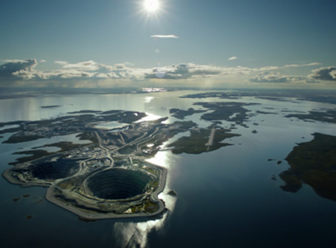


INSURANCE SATELLITE REMOTE SENSING
Precio : 1-12 USD/km²
Combining satellite remote sensing technologies with rights confirmation data and land parcel segmentation technology can vectorize and spatialize the subject matter of insurance, then establish a spatial database of the subject matter of insurance to provide spatial data and analysis management support for insurance underwriting and claim settlement.
SATELLITE REMOTE SENSING FOR AERIAL IMAGERY ANALYSIS INSURANCE FEATURES
1
Accurate Risk Assessment: Satellite aerial imagery analysis insurance can provide detailed information on properties, such as their size, shape, location, and condition. This can help insurers to accurately assess the risks associated with a property and determine appropriate coverage and premiums.
2
Data breach coverage: Satellite aerial imagery analysis insurance often involves handling sensitive data, which can be vulnerable to cyber attacks. This aerial imagery insurance can provide coverage for data breaches and associated costs, such as legal fees, notification expenses, and credit monitoring services.
3
Data Analytics and Predictive Modelling: Satellites used for remote sensing in insurance can provide insurers with a wealth of data that can be used to develop predictive models and identify patterns and trends. This can help insurers to better understand risks and make more informed decisions about coverage, premiums, and underwriting.
4
Improved Underwriting: Satellite aerial imagery analysis insurance can help insurers to identify and evaluate risks that may not be visible through traditional methods, such as physical inspections or surveys. This can lead to more accurate underwriting and better risk selection.
5
Enhanced Customer Experience: By leveraging satellite aerial imagery analysis, insurers can provide their customers with more personalized and customized insurance solutions, based on the specific risks associated with their properties. This can lead to increased customer satisfaction and retention.
Chang Guang Satellite Technology Co., Ltd. is a satellite factory, we provide aerial imagery analysis insurance, aerial imagery insurance, satellite data service, etc. For more information, please feel free to contact us!
Persona a contactar : global jl1, 0431 81785188
Buen trato: comprar del vendedor
Por favor, lea nuestras condiciones de uso. También puede visitar nuestras preguntas frecuentes y ver nuestra información sobre los riesgos relacionados con la falsificación.
|
Esta página es acerca de los importadores y exportadores de INSURANCE SATELLITE REMOTE SENSING Buscar en la categoria : B2B Servicios Buscar en la categoria : remote, insurance, satellite, sensing |
Reportar abuso

Tuesday 16 February 2016
Cantidad : 5000MT - Precio : 450 USD / MT CIF
Inhibit tumor growth and improve disease resistance; Powerful anti-oxidant which extends life, and improves the memory; Neutralize the side effects of chemotherapy and radiation; Normalize blood pressure & balance blood sugar Lower cholesterol, lose weight. Support eye health...
KHUN JACK PARTNERSHIP LIMITED
- 50000 - CHIANG MAI
- +66 9 56 19 49 81
Reportar abuso
Saturday 11 July 2015
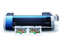
Cantidad : 1 - Precio : $3,429.00
Truly affordable. Remarkably versatile. With the VersaStudio, we've taken everything that makes a Roland printer great and packed it into one powerful, profit-producing package. Award-winning mild solvent inks. Your choice of media. One device that can print and cut an incredible...
Asia Toner Inc
- 12950 - Jakarta
- 6281361223405
Reportar abuso
Monday 30 September 2013
Cantidad : 200 tones - Precio : négociable
productor y exportador de mejor Nour Deglet data de Argelia de trroire Tolga Ubicación : rue el emir abdelkader Tolga , 07300 Tolga, Persona a contactar : RACHID MOSBAH, +21 3 50 15 07 11
2M silverston development co,;ltd
- 07300 - Tolga
- +21 3 50 15 07 11
- +213550150711